


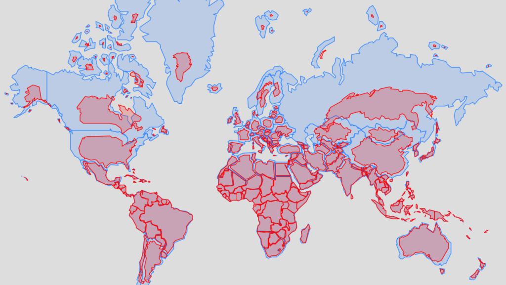
On September 4, 164 nations backed a resolution calling for the replacement of the so-called Mercator projection, in use since the 16th century, with a model developed in 2018.
The United States was the sole country to vote against the UN General Assembly draft resolution. Six other states—Ukraine, Moldova, Georgia, Serbia, Lithuania, and Estonia—abstained.
As experts explain, in the Mercator projection, landmasses are significantly exaggerated in size the farther they are from the equator. As a result, Africa appears drastically understated compared to territories such as Russia, Canada, and Greenland.
The reform is strongly supported by the African Union, which stated that map distortions have led to a “symbolic diminishment” of the continent in the eyes of the world.
Togo’s representative, who led the negotiations, emphasized that the UN vote confirmed the Mercator projection has had a “long-term cognitive, educational, cultural, geopolitical, and socio-economic impact, leading to a drastic reduction in the perceived size of Africa and other regions of the world in the global collective consciousness.”

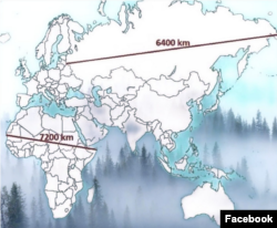
The UN resolution does not compel states to discard the old map; however, it urges governments, educational institutions, international organizations, and tech giants to transition to the 2018 Equal Earth projection, which represents countries’ actual surface areas more accurately.
Flemish cartographer Gerardus Mercator designed his map in 1569 to aid maritime navigation, charting lines of constant compass bearing as straight lines. This projection remained the global standard for nearly five centuries.
Under this mapping method, however, landmasses appear increasingly larger the farther they are from the equator. Visually, Greenland appears roughly equal in size to Africa, even though the Danish territory is in fact 14 times smaller than the African continent.
Togolese Foreign Minister Robert Dussey noted: “A map is never neutral. It shapes worldviews, influences perceptions of the role of peoples and continents globally, and can—often from the earliest years of schooling—entrench notions far detached from geographic reality.”
A number of critics also argue that the Mercator projection reinforced colonial mindsets by minimizing the scale of African nations while visually magnifying Europe, North America, and other northern regions.
Ahead of the September 4 vote, the draft resolution received the backing of French Foreign Minister Jean-Noël Barrot. Some experts viewed Paris’s stance as an effort to bolster its standing among its former colonies.
“We will move away from the Mercator projection and prioritize cartographic representations adapted to specific tasks, which more faithfully depict the real surface area of territories and reflect the recommendations of cartographers and scientists,” the French foreign minister concluded.